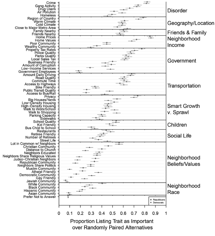
Sorting
This Week
Three stories about how our cities are divided:
–
- By Partisanship
–
- By Race
–
- By Land Use
class: center, middle, inverse
Story 1:
The Density Divide
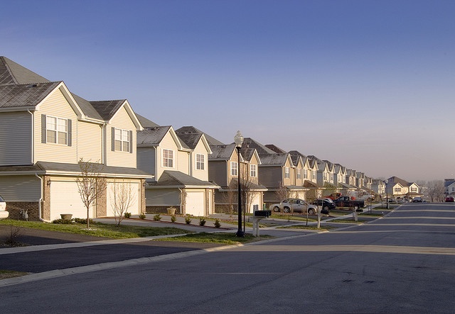
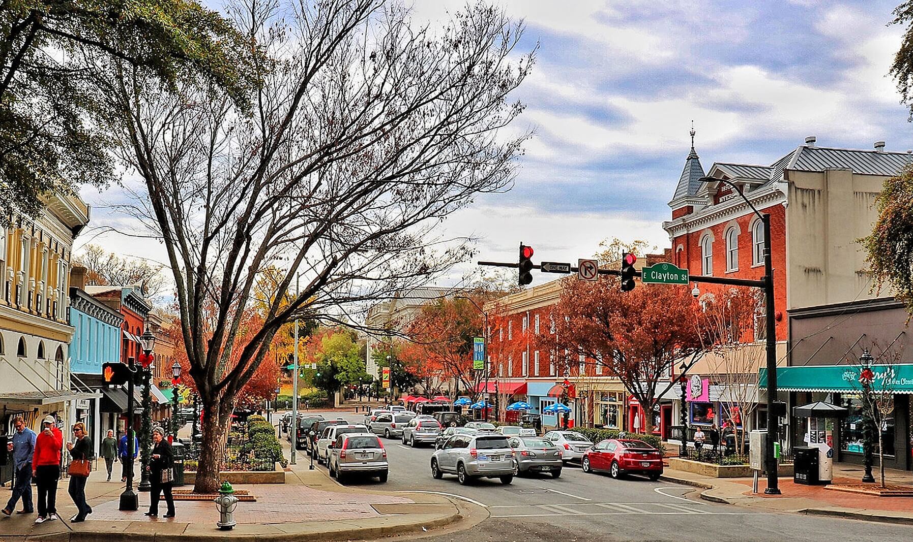
Let’s Play The Google Street View Game
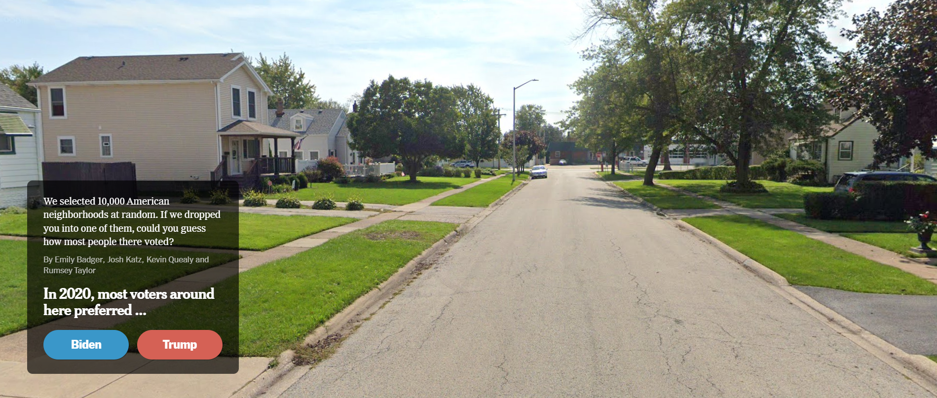
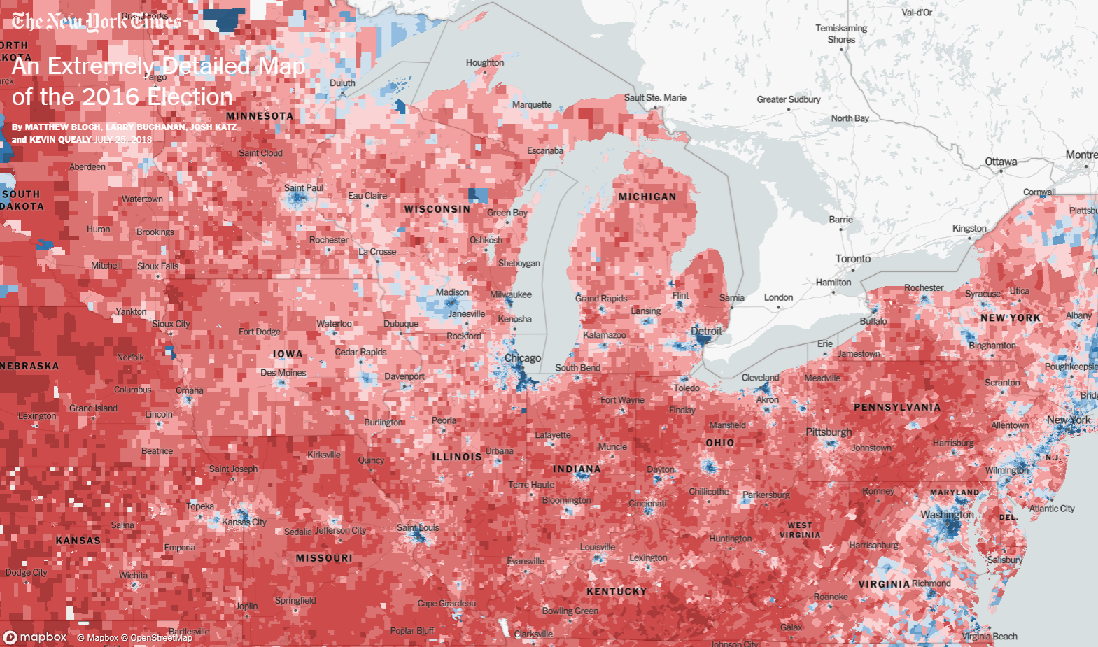
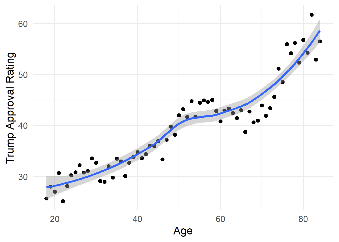
Densely Populated Places Are More Democratic
Why Are We Sorted?
.pull-left[
Historical Path Dependence
Selective Migration
Party Polarization: Age/Race
Party Polarization: Personality
]
.pull-right[
]
Why Are We Sorted?
.pull-left[
Historical Path Dependence
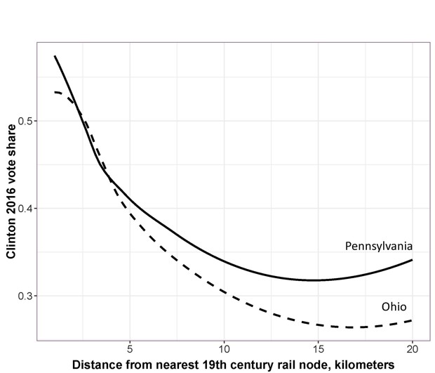
- Democrats today tend to cluster near 19th century rail nodes, where the labor movement was strongest .cite[(Rodden 2019)].
Selective Migration
Party Polarization: Age/Race
Party Polarization: Personality
]
.pull-right[
]
Why Are We Sorted?
.pull-left[
Historical Path Dependence
Selective Migration
Party Polarization: Age/Race
Party Polarization: Personality
]
.pull-right[
]
Why Are We Sorted?
.pull-left[
Historical Path Dependence
Selective Migration
- People prefer to live near like-minded people .cite[(Bishop 2004)].
Party Polarization: Age/Race
Party Polarization: Personality
]
.pull-right[
]
Why Are We Sorted?
.pull-left[
Historical Path Dependence
Selective Migration
People prefer to live near like-minded people .cite[(Bishop 2004)].
In practice, however, we see little evidence that partisanship is a strong predictor of neighborhood choice .cite[(Mummolo & Nall 2017).]
Party Polarization: Age/Race
Party Polarization: Personality
]
.pull-right[
]
???
When you ask people what they’re looking for in a neighborhood, and look at actual migration patterns, “partisanship of neighbors” rarely cracks the top 50 in the list of concerns.
Why Are We Sorted?
.pull-left[
Historical Path Dependence
Selective Migration
Party Polarization: Age/Race
- Age and race are increasingly strong predictors of party preference.
Party Polarization: Personality
]
.pull-right[
]
Why Are We Sorted?
.pull-left[
Historical Path Dependence
Selective Migration
Party Polarization: Age/Race
Age and race are increasingly strong predictors of party preference.
Geographic sorting by these characteristics also sorts us by party.
Party Polarization: Personality
]
.pull-right[
]
Why Are We Sorted?
.pull-left[
Historical Path Dependence
Selective Migration
Party Polarization: Age/Race
Party Polarization: Personality
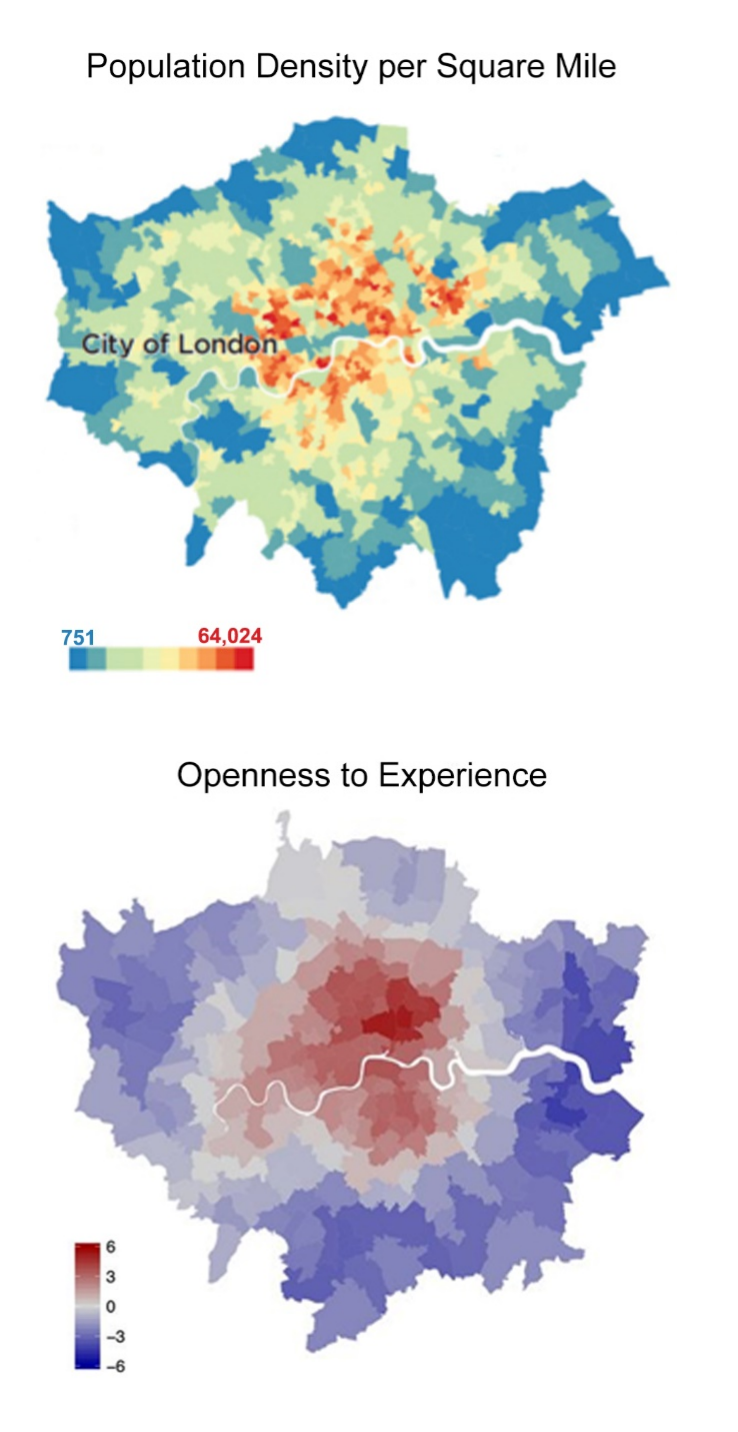
- Liberals score higher on “Openness To Experience”, place a higher value on the diversity of people and amenities in denser cities .cite[(Jokela et al. 2015; Wilkinson 2019)].
]
.pull-right[
]
Why Are We Sorted?
.pull-left[
Historical Path Dependence
Selective Migration
Party Polarization: Age/Race
Party Polarization: Personality
Liberals score higher on “Openness To Experience”, place a higher value on the diversity of people and amenities in denser cities .cite[(Jokela et al. 2015; Wilkinson 2019)].
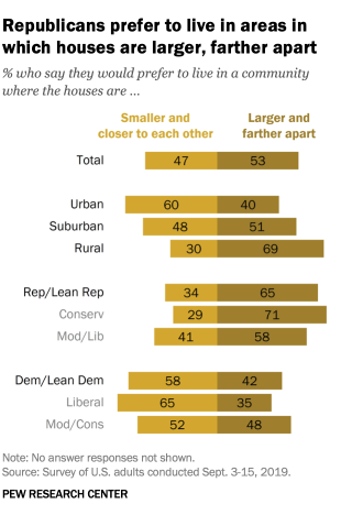
Conservatives tend to prefer more space .cite[(Pew 2019)].
]
.pull-right[
]
Why Does It Matter?
–
- Affective Polarization (positive feelings toward your own party, negative feelings toward the opposing party) may be exacerbated when you don’t have ordinary interactions with members of the opposing party .cite[(Iyengar et al. 2019)].
Why Does It Matter?
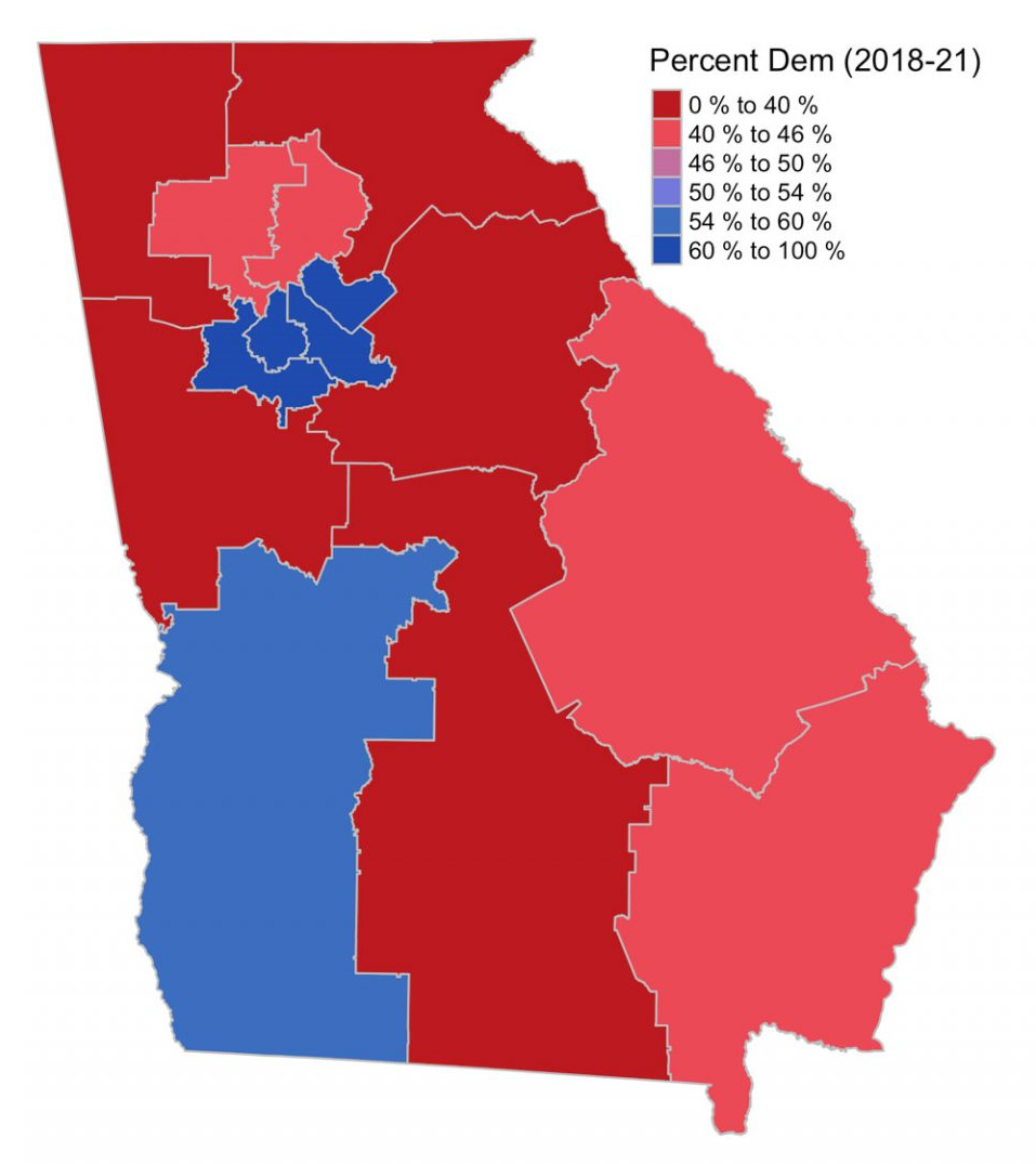
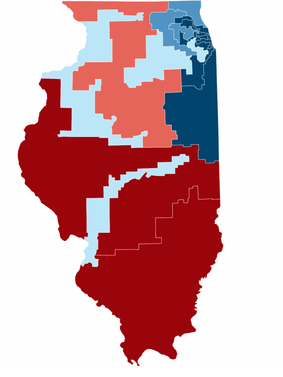
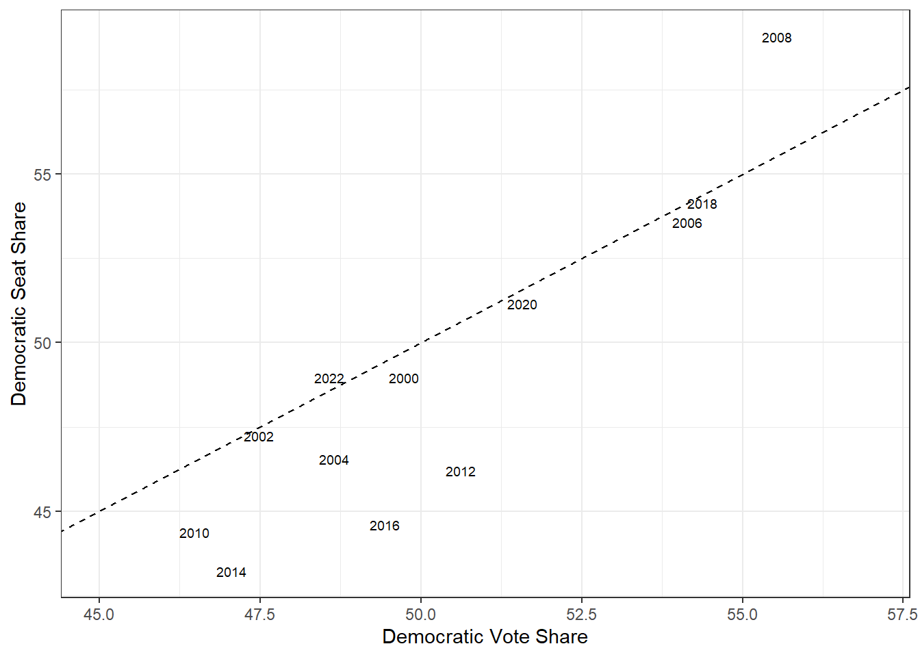
- “Unintentional Gerrymandering”: With single-member districts, the party that is densely packed into cities has a structural disadvantage in electoral politics.
–
Why Does It Matter?
.pull-left[
]
–
.pull-right[
]
???
Why Does It Matter?
As a result, Democrats tend to win less than a proportional share of seats in the US House of Representatives.
class: center, middle, inverse
Story 2:
Why Your Neighbors All Look Like You
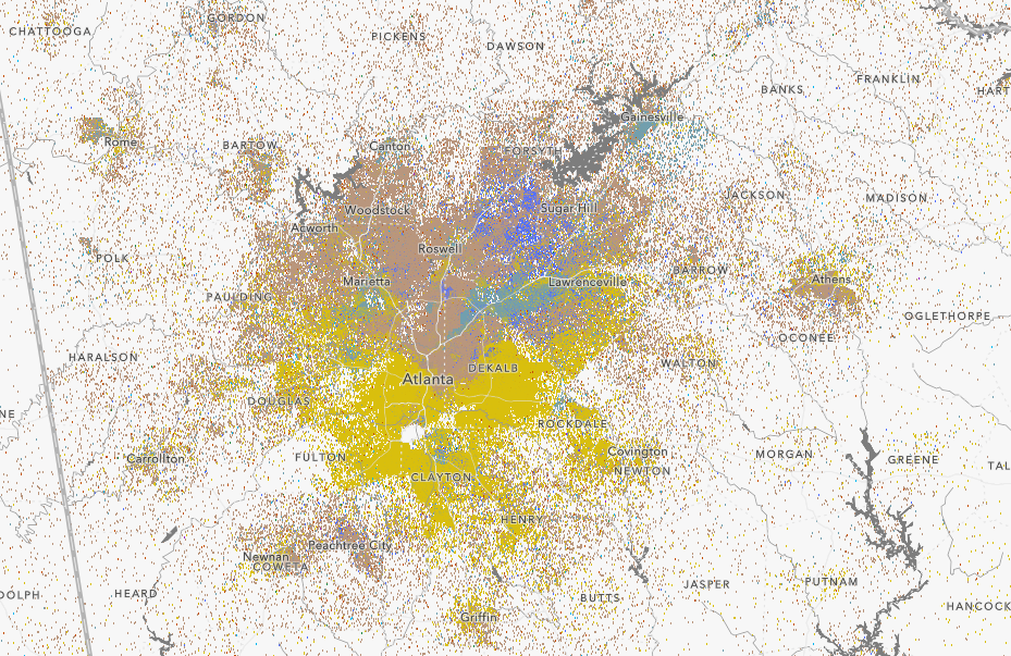
Residential Segregation
Think for a moment about the neighborhood where you grew up.
???
https://docs.google.com/spreadsheets/d/1qn-49VIEQfKy26uBrtfY2H4MTYjhF5SDhkQ6Hkt0Q6Q/edit?usp=sharing
The Dot Map
Why Are We Segregated?
–
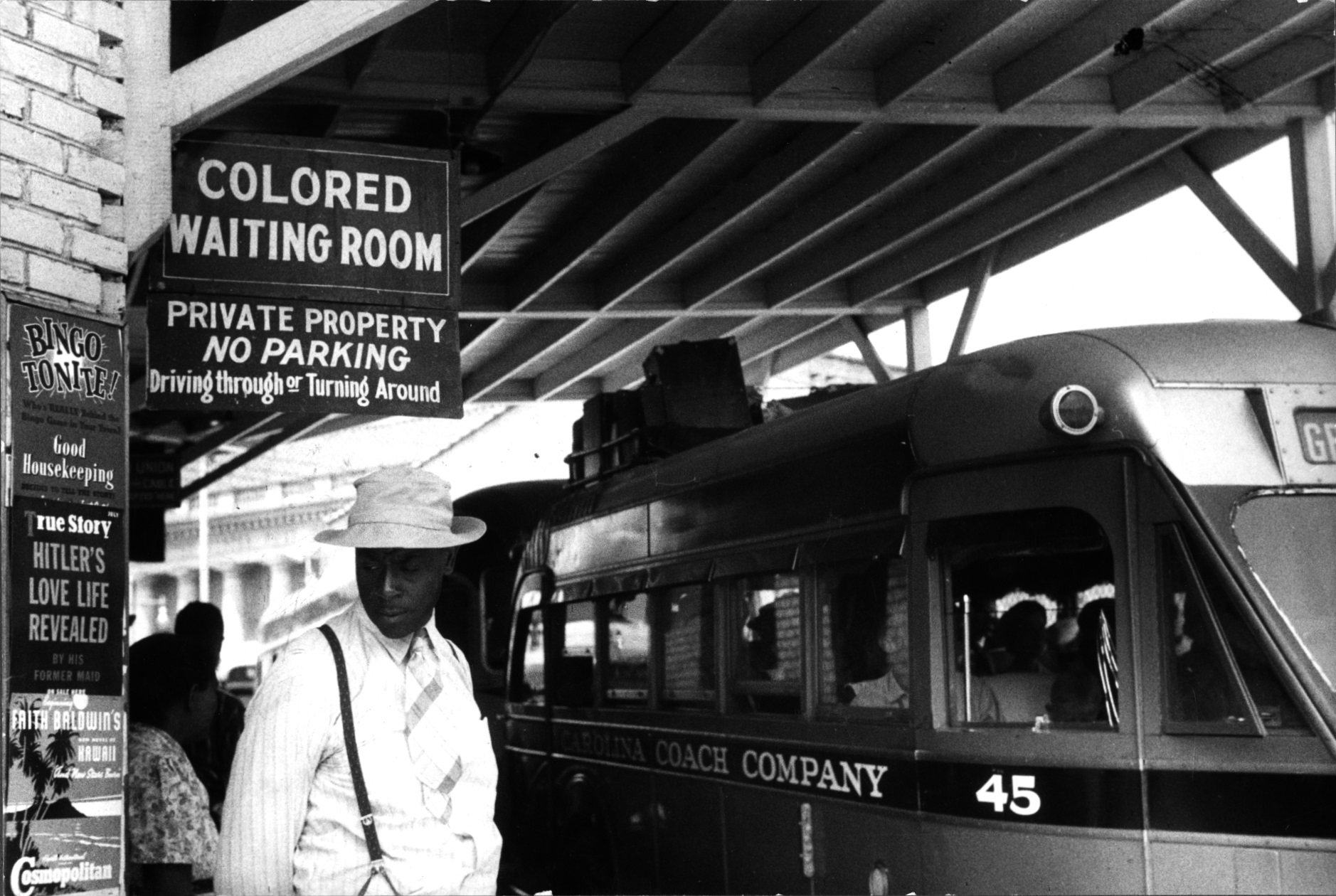
One set of explanations emphasizes de jure segregation. Laws that deliberately created segregated neighborhoods.
–
.pull-left[
Jim Crow Laws
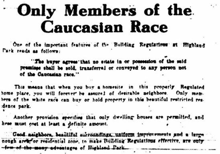
Racial Covenants
Redlining
]
.pull-right[
]
???
- HITLER’S LOVE LIFE REVEALED!!
- But in the country more broadly, there were a multitude of laws and governmental interventions that segregated the housing market.
Why Are We Segregated?
One set of explanations emphasizes de jure segregation. Laws that deliberately created segregated neighborhoods.
.pull-left[
Jim Crow Laws
Racial Covenants
Redlining
]
.pull-right[
]
Why Are We Segregated?
One set of explanations emphasizes de jure segregation. Laws that deliberately created segregated neighborhoods.
.pull-left[
Jim Crow Laws
Racial Covenants
Redlining
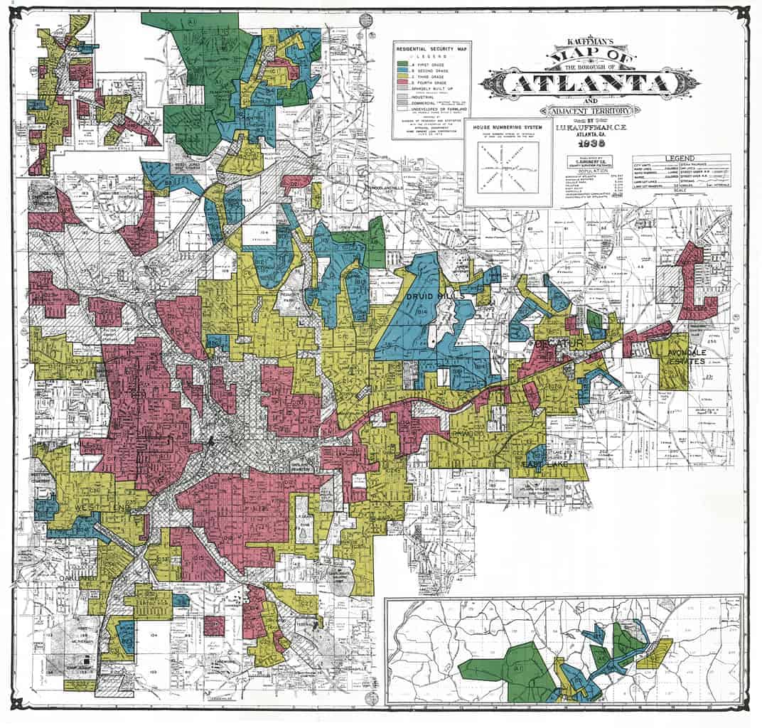
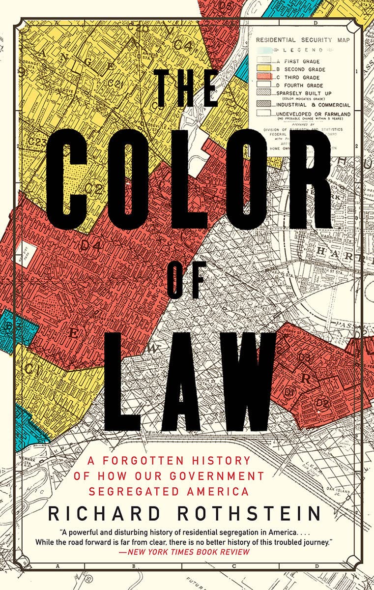
New Deal Era federal agencies (like HOLC, the Home Owner’s Loan Corporation) were less likely to extend loans in “risky” neighborhoods.
Guess which areas were colored in red (risky)?
Cities that HOLC appraised are more likely to be segregated today .cite[(Faber 2020)].
]
.pull-right[
]
???
New Deal Era federal agencies (like HOLC, the Home Owner’s Loan Corporation) designed to help people finance their homes were more likely to extend loans in less “risky” neighborhoods. Guess which areas they colored in red (risky)? Cities that HOLC appraised are more likely to be segregated today, and have larger racial wealth gaps (Faber)
.pull-left[
]
.pull-right[
]
Why Are We Segregated?
Another set of explanations emphasizes de facto segregation. People prefer living near similar people.
–
Why Does It Matter?
–
- So much economic opportunity is linked to our neighborhoods .cite[(Chetty et al.)].
–
- Racially segregated cities are more politically polarized .cite[Trounstine (2015)].
–
- Contact Hypothesis: We’re more likely to trust and understand people if we interact with them regularly .cite[Carrell et al. (2015); Brown et al. (2021).]
–
Fortunately, there is some good news:
???
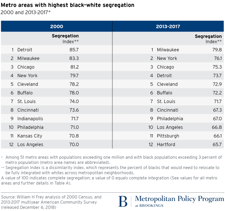
Dissimilarity index: roughly speaking, what percent of people need to move before an area becomes perfectly integrated? In Detroit in 2000, it was about 85%. But now it’s 15 points lower! Diversification of downtowns, plus increasing numbers of Black Americans moving to suburbs, means that we’ve started making a dent in racial segregation. Still a long way to go, but I for one am cautiously optimistic.
class: center, middle, inverse
Story 3:
The Origins of Zoning
Zoning

???
In SimCity, the very first thing you do is segregate your city…by land use. Houses go here, shops go here, the landfill and coal power plants go way off in the corner.
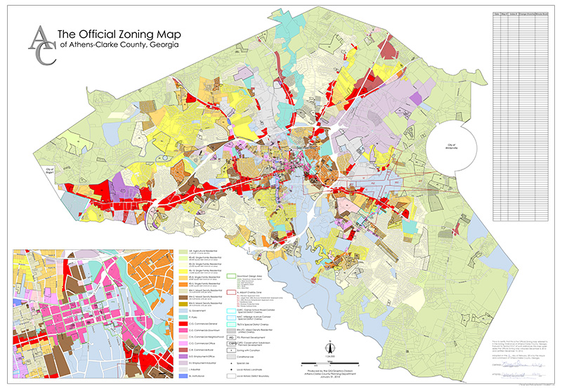
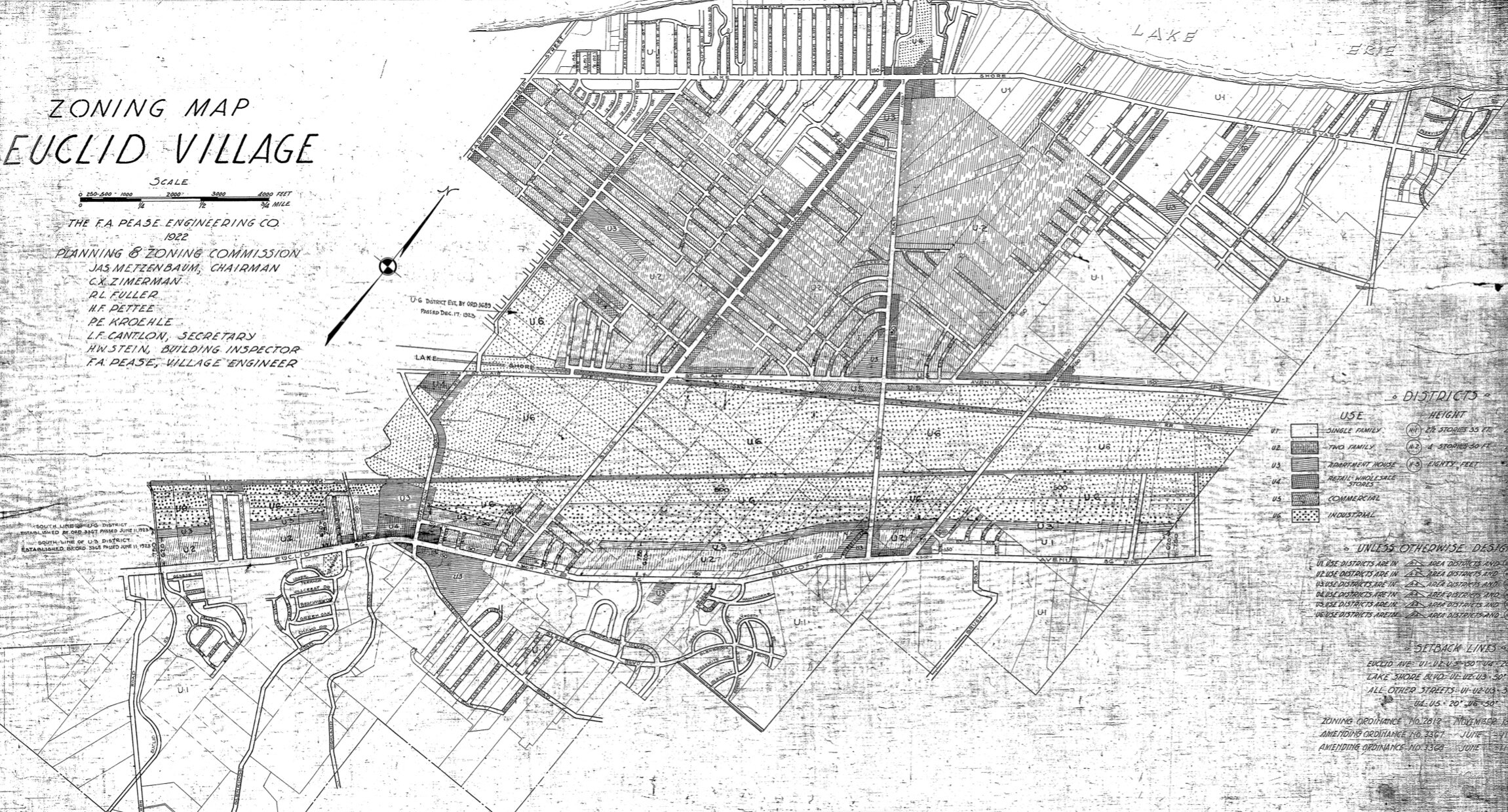
Zoning
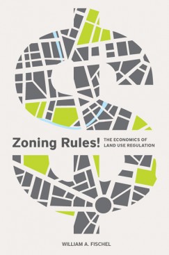
This is pretty true to life. Nearly every city in the United States has a map like this:
Zoning
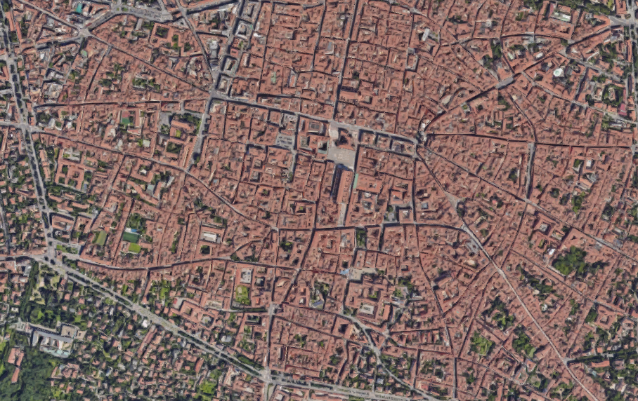
It didn’t used to be this way…
???
In any pre-modern city, there’s city planning, sure. You lay out the roads, you set aside some public space for a plaza, but the idea of dividing up a city into “zones”, each with their own particular purpose, is a thoroughly modern, 20th century, invention.
The Happy Bedtime Story About Zoning

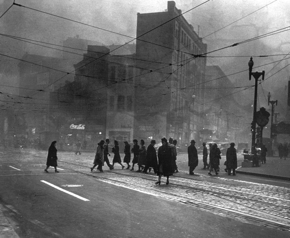
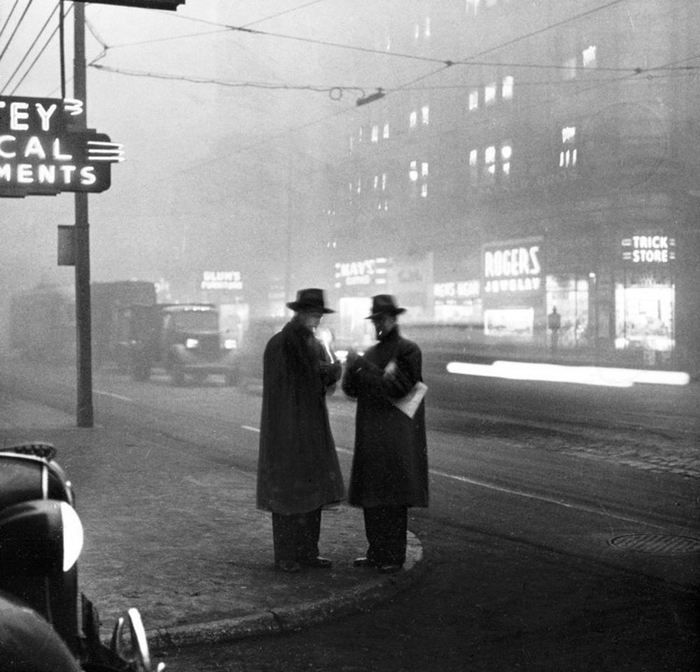
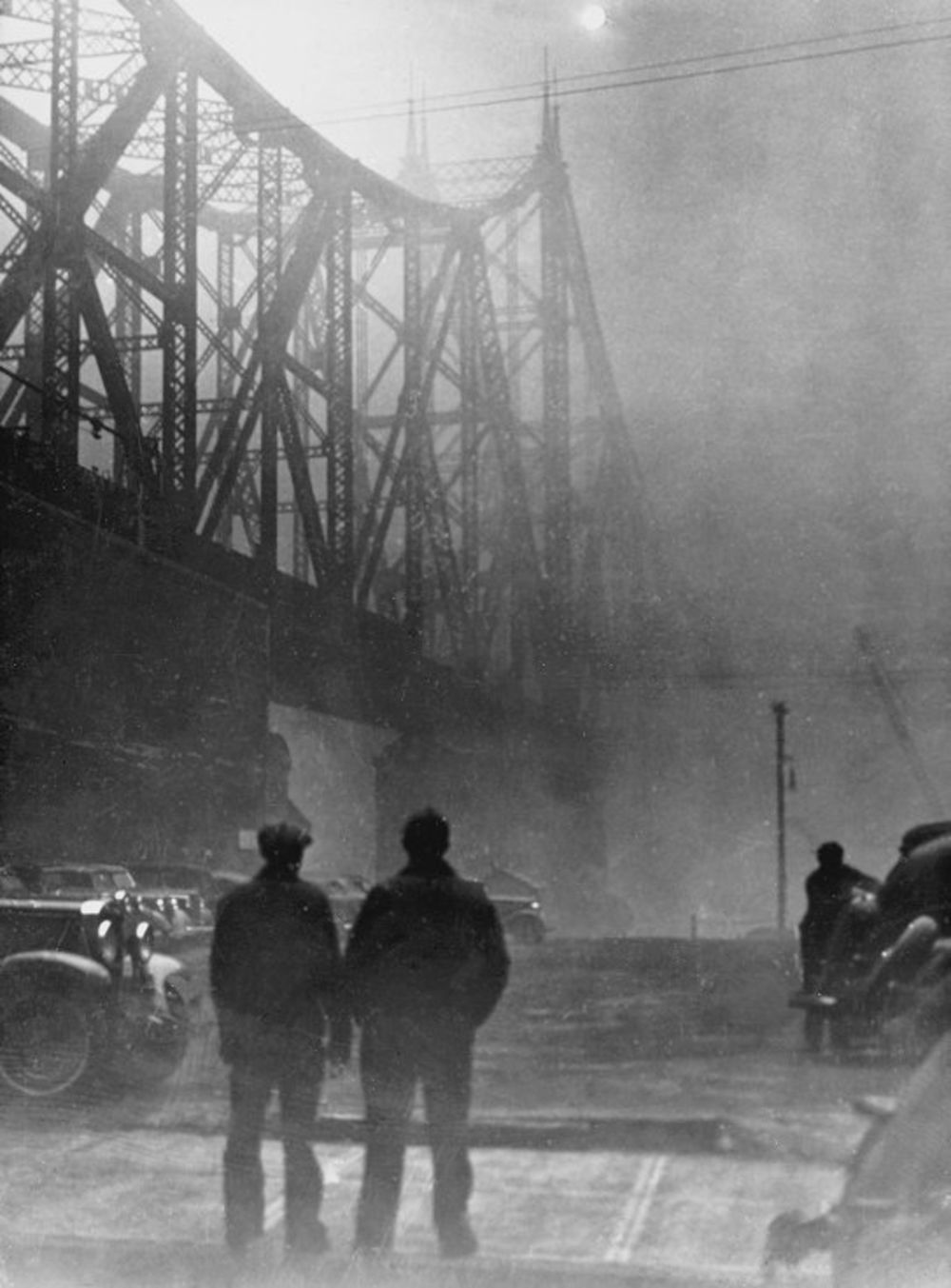
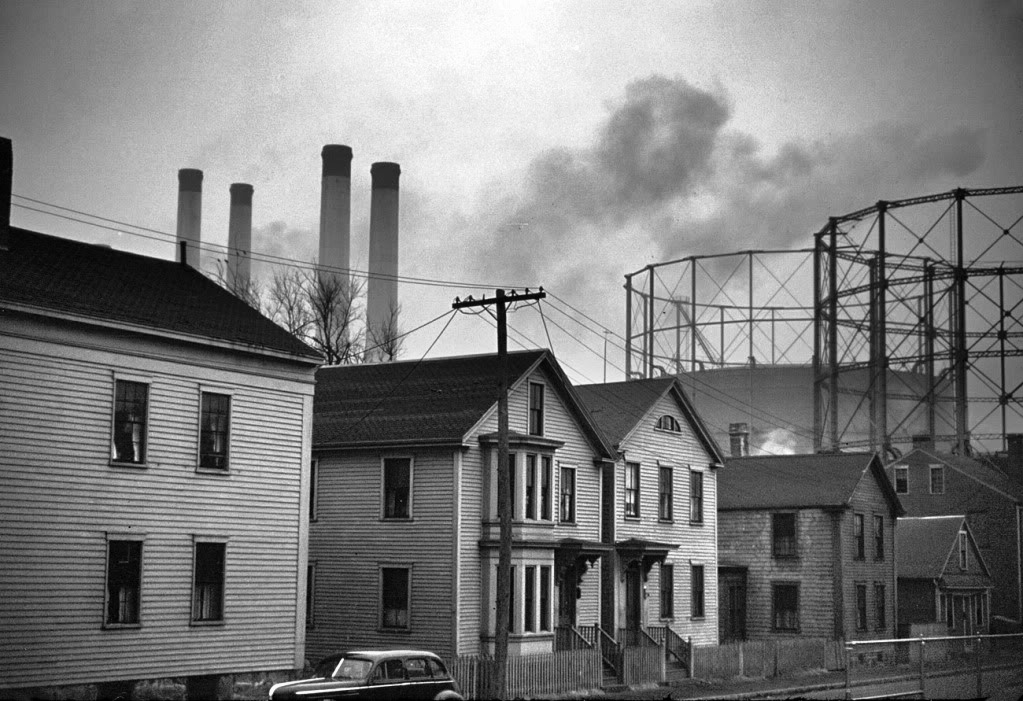
Pittsburgh, 1940s
.pull-left[
]
.pull-right[
]
Image Credit: Bloomberg / University of Pittsburgh
???
Bloomberg published this series of photographs from Pittsburgh back in its steel-producing heyday that I love.
https://www.bloomberg.com/news/articles/2012-06-05/what-pittsburgh-looked-like-when-it-decided-it-had-a-pollution-problem
Negative Externalities
Some land uses impose negative externalities on others.
–
–
The free market alone has a hard time handling negative externalities. And so the government steps in, using zoning to separate incompatible uses.
???
- Some uses of land impose negative externalities on other people. And it’s not easy for private citizens to negotiate the problem away.
- One of the key roles of government is to resolve these sorts of collective action problems.
- Zoning separates these incompatible uses.
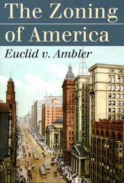
Euclid v. Ambler (1926)
???
In our happy story, towns like Euclid OH create land use maps to separate incompatible uses. Ambler Realty sues, arguing that the village violated the 14th amendment, seizing the value of its land without due process. The practice gets upheld by the Supreme Court in 1926.
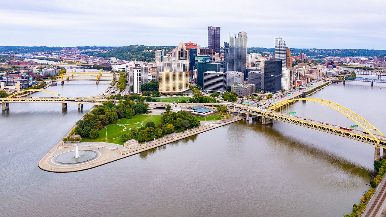
Pittsburgh Today
The Gritty Rebooted Bedtime Story About Zoning
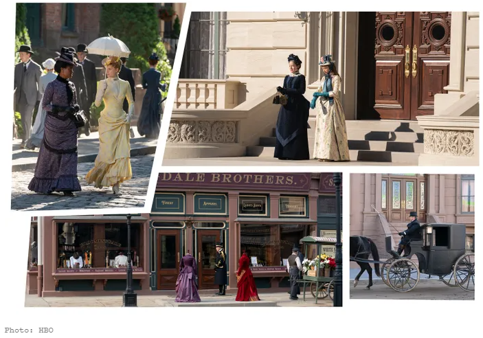
New York, 1880s
???
My guilty pleasure TV: HBO’s the Gilded Age. Real Housewives of New York, but in 1880. You know, the new money Vanderbilt stand-ins build a gaudy Upper East Side mansion directly across from the old money Van Rhijns, but the Astors obviously can’t let them into polite society just because they have a lot of money I mean for God’s sakes their chef isn’t even from France and they eat with all the wrong silverware.
New York, 1880s
.pull-left[
Where do you build your gaudy New York City mansion in the 1880s?
- 61st Street and 5th Avenue
(Historical Path Dependence Alert!)
]
.pull-right[
]
???
At any rate, where do the wealthiest New Yorkers live? 61st street and 5th Avenue. Why? Well, before New York had a zoning code, it’s the closest you can be to the Financial District while safely avoiding the poors and the factories. Factories can’t be far away from rail depots or the docks, because that’s where you load and unload your goods. Poor people in their apartment buildings can’t be far from the street car lines.
- This is pre-zoning, so the Astors and Vanderbilts can’t keep slaughterhouses away from their grand houses by making it illegal. Instead, they simply build their houses here, where you can still ride a carriage to get downtown, but away from the street cars and elevated railways and docks. (Historical path dependence alert! The Upper East Side is still the place where all the New York old money live today, despite the original reason for living there disappearing.)
The Internal Combustion Engine Changes Everything
–
.pull-left[
1904-1905:

]
–
.pull-right[
1917:
Suddenly, industry is not confined to the railyards and the docks, and the apartment buildings are not confined to the streetcar lines!
]
???
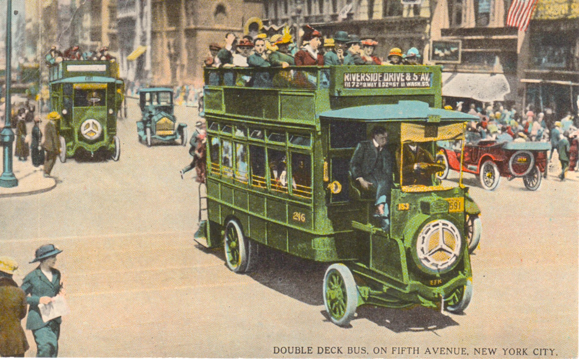
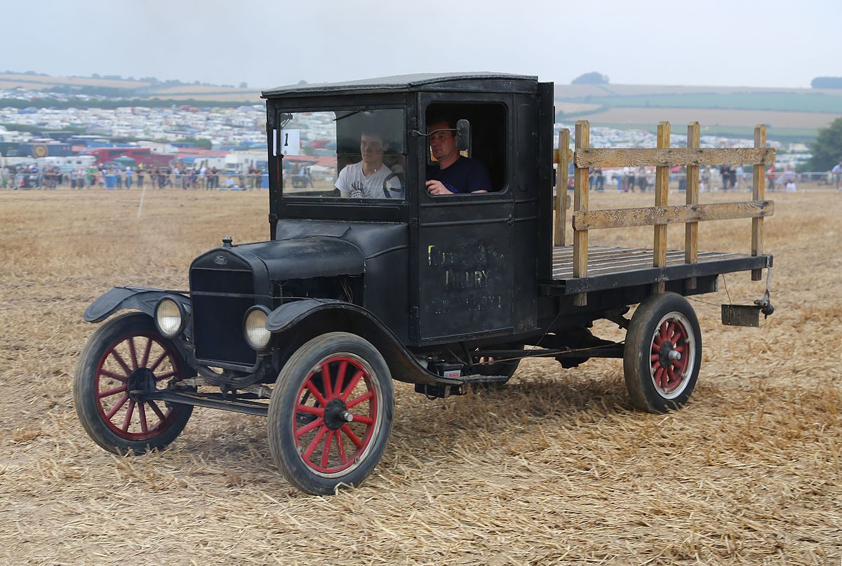
- Trucks (model-tt, rolled out in 1917) and buses (nyc-bus, 1904, and double-decker (1905). https://ephemeralnewyork.wordpress.com/tag/first-bus-new-york-city/
- Suddenly, industry is not confined to the docks and the railroad lines, and poor people can live anywhere. Naturally, the city’s monied classes are outraged, and lobby for change.
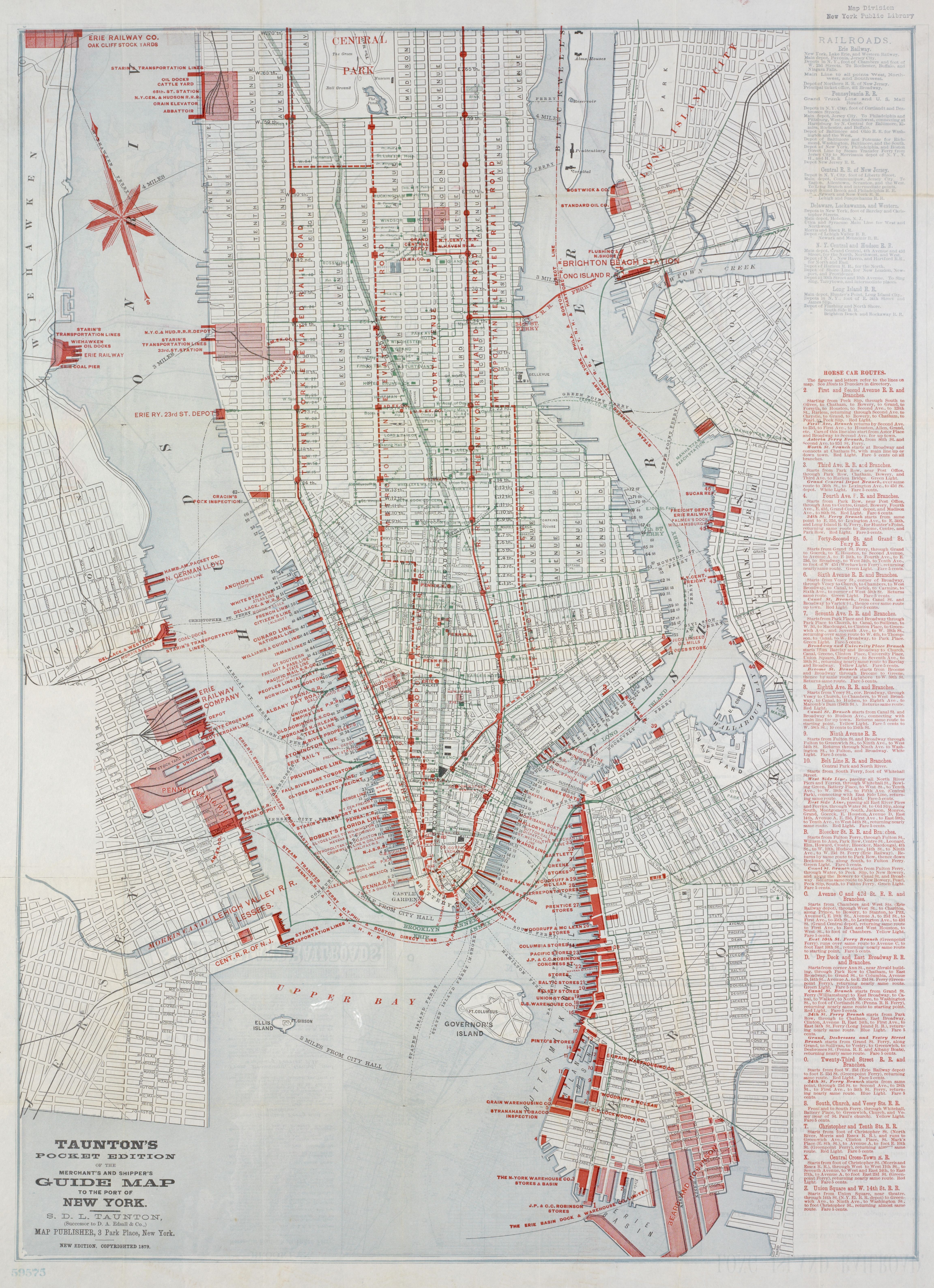
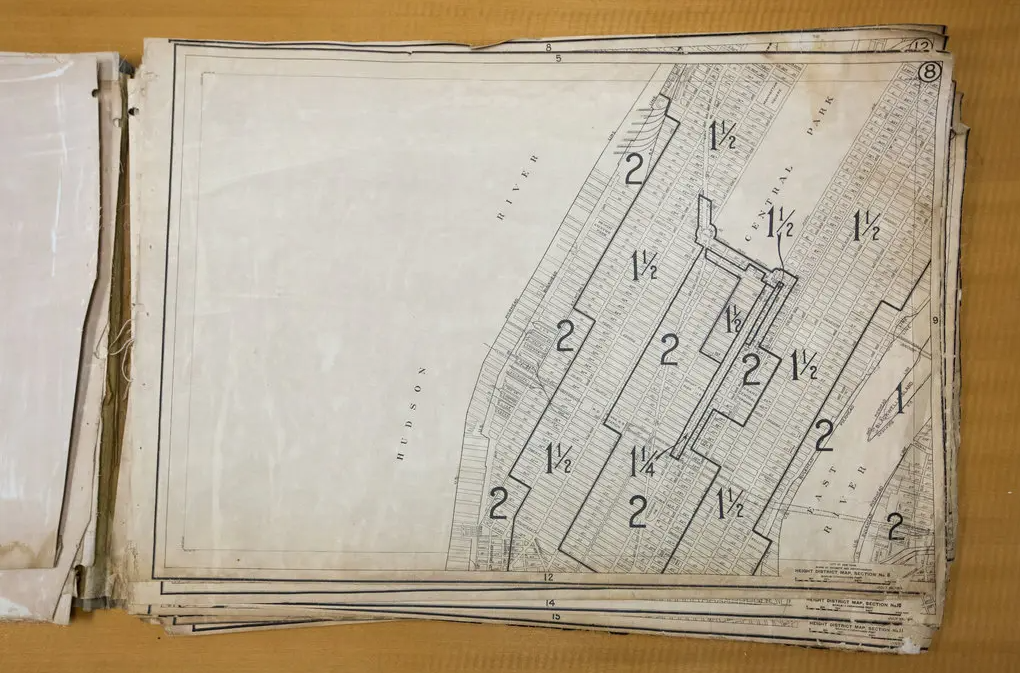
New York’s First Zoning Map (1916)
???
At first, rudimentary height restrictions (what multiple of street size your building can be without setbacks.)
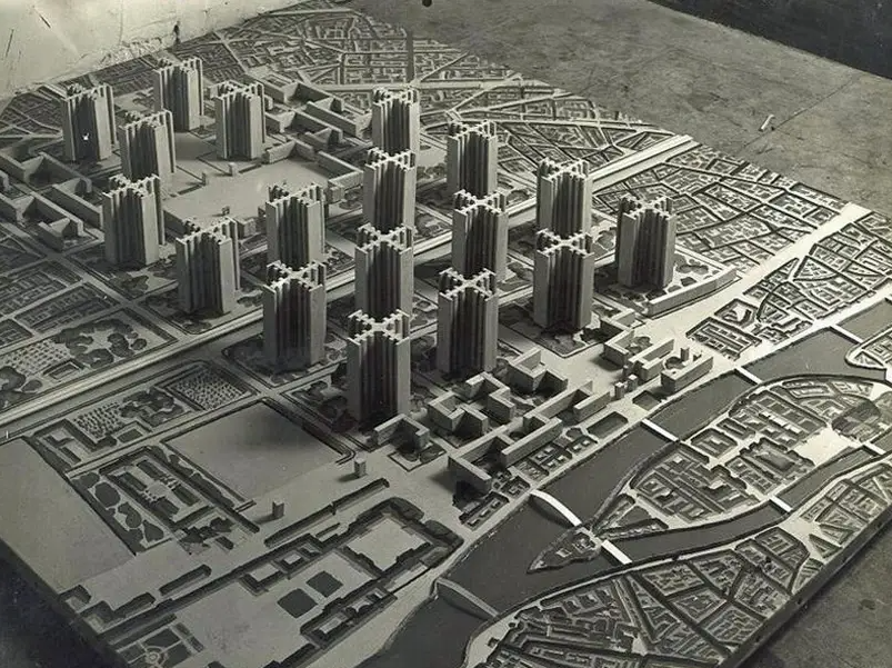
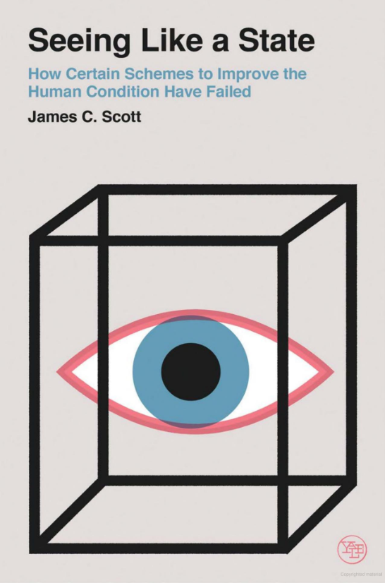
The High Modernists
Adoption of zoning codes coincides with a movement that James Scott calls “High Modernism”.
–
.pull-left[

]
.pull-right[
]
–
Characterized by a love of rectangles, open space, strict separation of uses, and a general zest for tearing everything down and starting over.
???
Le Corbusier / High Modernists viewed pre-modern cities as dirty, unorganized, and in need of rationalist urban planning.
Why Does It Matter?
–
- Strict zoning regulations create housing shortages (more on this in the Housing module).
–
- Single-use zoning strains transportation systems by putting distance between where people live, work, and play (more on this in the Transportation module).
–
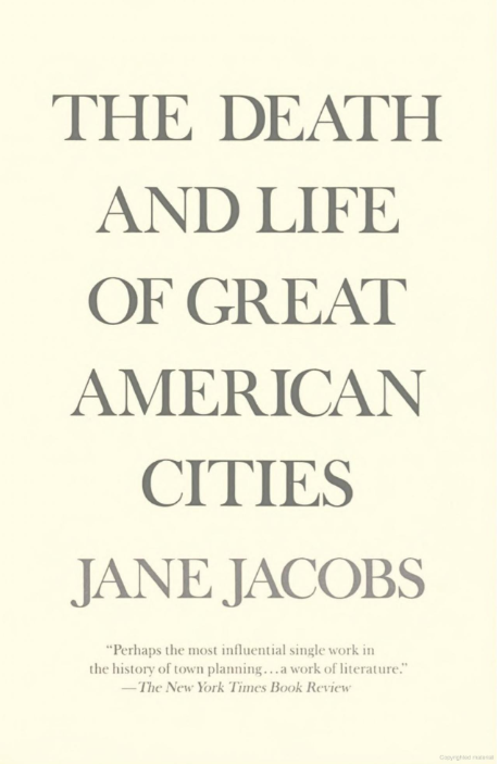
- Strict separation of uses saps cities of life.
.pull-left[
]
.pull-right[
]
???
- Manhattan has fewer people today than it did a hundred years ago when it created its first zoning map.
- I encourage you to take the next few weeks walking around Athens, and think about the way you feel in different places. Which places feel alive? Which places feel dead? Chances are the living places contain a mixture of uses, such that there’s always somebody there doing something.
.pull-left[
]
.pull-right[
]